Walks Around Buninyong and District
Buninyong Village and surrounds provides many opportunities for walkers of all levels of fitness. One of the difficulties has previously been the provision of suitable, accessible information on the various walks.
This site provides full descriptions of a wide range of interesting walks around Buninyong and District. Some can be completed in half an hour, some take several hours. Each walk is supported by clear and detailed customised maps, points of interest for walkers, an indication of the walk’s distance, the time required, difficulty levels, and co-ordinates for the start and finish points.
It is the ideal guide for walking groups or individual walkers interested in exploring the magnificent volcanic country around Buninyong. Happy walking!
Buninyong Walking Tracks
Information on a range of walking tracks can be found on this website, ranging from short heritage walks around the town to fully documented longer walks with maps with embedded GPS co-ordinates, eg Buninyong Bird Park Walk. (See more below)
Recent Walks Development
The Jessie McIntosh Memorial Walk is an 18 km mainly bushland circuit from Buninyong through Durham Lead. Jessie was a four year old who wandered away from home near the junction of Lal Lal St and Webb’s Hill Rd Buninyong, in 1867 and her body was found in King’s Gully, East of Durham Lead. Jessie is buried in the Buninyong Cemetery.
Future Walks Development
More maps and walk descriptions will gradually be added.
Coming soon: detailed lists of roadside vegetation.
The Buninyong Bird Park Walk has been developed as a model for providing this information, hopefully, the first of the many walks that will be recorded on this website. Walkers are able to print out copies of the information to guide them on the walk.
There are four elements to the format by which the walk information has been provided:
- Summary Sheet giving distance, location and other relevant information;
- Walking Notes – a description of the walk
- Background Information – notes on points of interest
- A Map with GPS co-ordinates embedded, so the map can be downloaded to an iphone or ipad, where the map can be used in a similar way to a vehicle GPS.
Although there are direction posts and signs on sections of walk (Goldfields Track, Biolink Trail), there are no posts or signs related to this walk. The benefits of this approach are many. There are no problems with vandals removing posts or defacing signs, information and maps on the walk are always available on the website and changes to the information provided are easily made. The information and map provided are all that is required to take this walk.
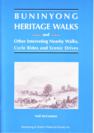
Several interesting walks around Buninyong are also described with detailed annotations in Buninyong Heritage Walks ($5.00), published by the Buninyong & District Historical Association
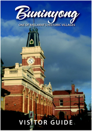
The Buninyong Visitor Guide (free), produced by the Buninyong Community Association, also has a map of an easy one-hour walk around Historic Buninyong.
Both booklets are available at the Buninyong Information Centre (Old Library) and the Buninyong Post Office.